Fil:Africa-countries-northern.png
Det finns ingen version med högre upplösning.
Africa-countries-northern.png (360 × 392 pixlar, filstorlek: 10 kbyte, MIME-typ: image/png)

|
En vektorversion av denna bild (SVG) finns tillgänglig.
Den skall användas istället för denna rasterbild, när det är fördelaktigt. File:Africa-countries-northern.png → File:Africa-countries-northern.svg
För mer information om vektorgrafik, se artikeln Commons transition to SVG (engelska). Det finns också information om MediaWikis stöd för SVG-bilder (engelska). |
 |
Sammanfattning
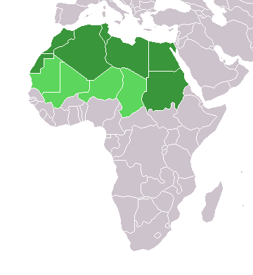
English: Map of countries in geo-political North Africa — as considered by the U.N.
- Credits
from en:Image:Africa-countries-northern.png

|
Tillstånd ges att kopiera, distribuera och/eller modifiera detta dokument under villkoren i GNU Free Documentation License, Version 1.2 eller senare version publicerad av Free Software Foundation, utan oföränderliga avsnitt, framsidestexter eller baksidestexter. En kopia av licensen ingår i avsnittet GNU Free Documentation License. |
| Denna fil har gjorts tillgänglig under licensen Creative Commons Erkännande-Dela Lika 3.0 Generisk | ||
| ||
| Detta licenstillägg lades till till denna fil som en del av GFDL:s licensuppdatering. |
Filhistorik
Klicka på ett datum/klockslag för att se filen som den såg ut då.
| Datum/Tid | Miniatyrbild | Dimensioner | Användare | Kommentar | |
|---|---|---|---|---|---|
| nuvarande | 17 mars 2018 kl. 17.22 | | 360 × 392 (10 kbyte) | Maphobbyist | Montenegro border |
| 31 mars 2016 kl. 23.00 |  | 360 × 392 (10 kbyte) | Fry1989 | Reverted to version as of 16:12, 13 January 2014 (UTC) | |
| 7 november 2015 kl. 11.37 |  | 360 × 392 (10 kbyte) | Hpyounes | correction | |
| 13 januari 2014 kl. 18.12 |  | 360 × 392 (10 kbyte) | VVVF | See http://unstats.un.org/unsd/methods/m49/m49regin.htm | |
| 13 januari 2014 kl. 17.59 |  | 360 × 392 (13 kbyte) | VVVF | Reverted to version as of 20:15, 9 July 2011. See http://unstats.un.org/unsd/methods/m49/m49regin.htm | |
| 20 juli 2011 kl. 14.47 |  | 360 × 392 (7 kbyte) | Kahusi | See http://unstats.un.org/unsd/methods/m49/m49regin.htm | |
| 9 juli 2011 kl. 22.15 |  | 360 × 392 (13 kbyte) | Maphobbyist | South Sudan has become independent on July 9, 2011. Sudan and South Sudan are shown with the new international border between them. | |
| 5 maj 2006 kl. 13.13 |  | 360 × 392 (4 kbyte) | Hautala | optimized with png | |
| 20 april 2005 kl. 18.30 |  | 360 × 392 (14 kbyte) | Yonghokim | map of countries in Northern Africa. from en:Image:Africa-countries-northern.png {{GFDL}} |
Filanvändning
Följande sida använder den här filen:
Global filanvändning
Följande andra wikier använder denna fil:
- Användande på ce.wikipedia.org
- Användande på es.wikipedia.org
- Användande på fr.wikipedia.org
- Användande på he.wikipedia.org
- Användande på ru.wikipedia.org
- Användande på sc.wikipedia.org